Santa Ponsa Yacht Club

OUR CLUB
Santa Ponsa Yacht Club is a sports club with a relaxing and family atmosphere, endeavouring to provide quality at all times, integrating into the surrounding environment and only 25 km from Palma Airport.
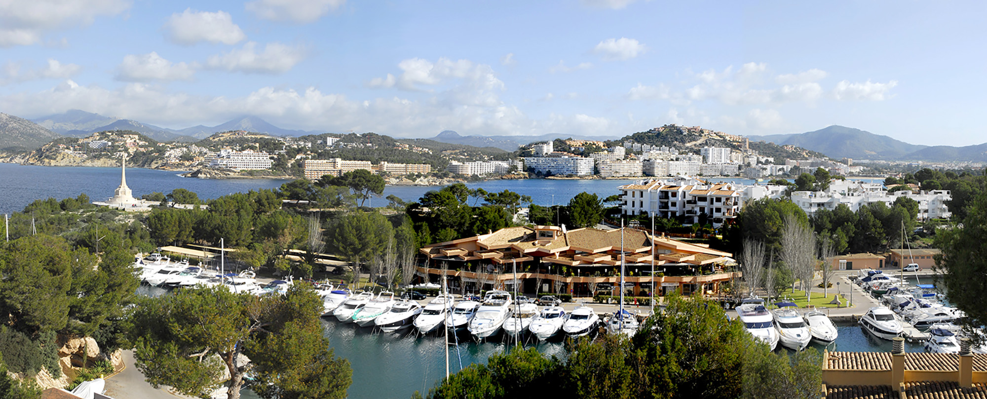
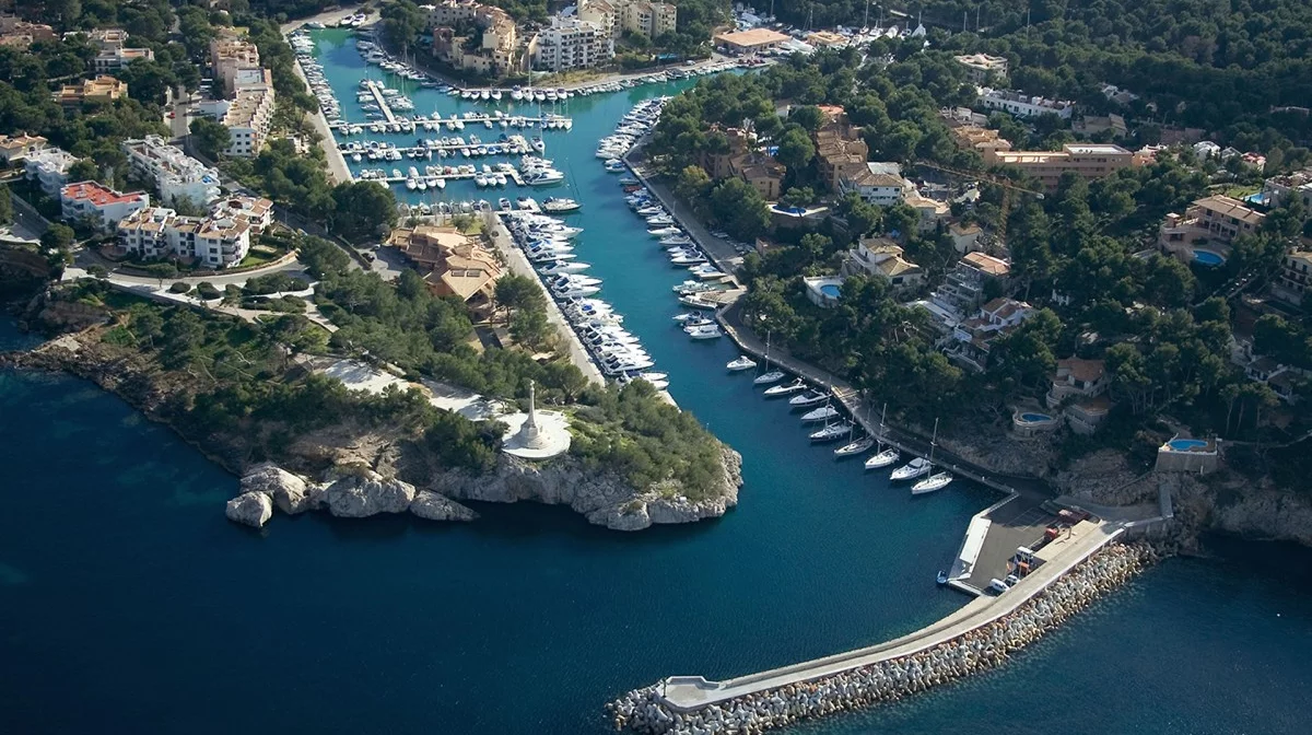
The port was built in 1975 utilizing the natural cove called “La Caleta”, whose history, as a natural port used for trading with the local town, dates back more than two thousand years, of which today only archaeological ruins of ‘Puig de Sa Morisca’ remain. On the 11th of September, 1229, King James I, the Conqueror, chose this site to disembark his troops and so began the conquest of Mallorca. To commemorate this event a cross was placed at the entrance of the port, which can be seen from all over the bay.
As one enters the port, leaving to starboard the fuel station, you will find a sheltered inlet, surrounded by gardens, which accommodates 522 boats ranging from 7 to 20m in length. The port has been designed to blend in with its natural surroundings, with only the necessary number of buildings to provide all the facilities and maximum security of a modern port that has been granted the “gold” distinctive referring to the technical security of the installations, environmental, sanitary and hygiene requisites and the quality of its services by Lloyd´s Register, the ISO 14001 certificate by Bureau Veritas and the “Q” of Quality by the Ministry of Tourism of the Govern of the Balearic Islands.

Constitution, Statutes and Governance
The Nautical Club Santa Ponsa was founded on April 14th 1971. On November 18th of the same year, the Statutes were approved, being registered in the National Register of Associations, under the name of Club Nautico Santa Ponsa Palma de Mallorca, section 3, number 8,678.
The Statutes of the club, as originally approved, were amended on several occasions in order to adapt to changing circumstances and to conform with legislation in force at the time.
The Governance of the Club, according to the approved Statutes, is entrusted to the General Assembly of members and the Board of Directors. The members, who established this constitution on the 18th November 1971, together formed the Managing Board of the Club under the chairmanship of D. Miguel Nigorra Oliver.
Preparatory works for the marina began in early 1970. The civil engineer, D. Jerónimo Sainz Gomila was responsible for drawing up the project. In February 1971 application was made in the name of IMISA to the Ministry of Public Works for planning permission for the Santa Ponsa Yacht Club project. Subsequent to this application and having founded the ‘Club Náutico Santa Ponsa’, further applications were made to ‘Costas y Puertos de Baleares’ and to the Ministry of Public Works, requesting the transfer of the concession of the yacht club, originally requested in the name of IMISA, to the name of the Club Náutico Santa Ponsa.
On 10th of January, 1975, a Ministerial Order was issued authorizing the construction and operation of the Santa Ponsa Yacht Club, with a number of conditions, including, we would point out, the concession for a period of 50 years and a stipulation that 20% of the moorings must be reserved for general public or transient use.
The construction of the project was awarded to the company ‘Cubiertas y Tejados S.A , these ending on the 10th of October, 1979 and being approved by the Head Office of ‘Costas y Puertos de Baleares’.
In 1997, following the transfer of powers from central Government to the Autonomous Communities, the Club is required to adapt the statutes to a unified model for all sailing clubs originally registered with the Spanish Sailing Federation, under the Decree of the CAIB 147/1997 of the 21st of November. In this way the constitution and operation of private sports clubs is regulated in the Autonomous Community of the Balearic Islands.
In view of the regulations to which the ‘Sports Associations’ are now subject in Decree 147/97, the possibility is considered to give up the special status of ‘Sports Association’ and to carry out the statutory modifications and necessary administrative procedures in order to register the club in the legal framework of associations of a more general character. As a result, in the Extraordinary General Meeting, held on the 25th September, 2000, it was agreed to amend the Statutes and register the club in the Registry of Associations of the Autonomous Community of the Balearic Islands. On the 18th of July 2002, the club was registered as the “CLUB NAUTICO SANTA PONSA”, under nº 4600 in the first section.
For the Club Náutico Santa Ponsa, the main advantage of this was to conserve the number of its members and each member to be the titleholder of a right of a berth. In this way the interests of the Club and its members always coincide.
History of “Sa Caleta of Santa Ponsa”
The history of the cove ‘La Caleta’, where our port is to be found, has always been linked to that of the hill known as ‘Puig de Sa Morisca’ at an altitude of 92 metres above sea level and situated half a mile southeast of the cove and which today is a protected area considered to be of archaeological interest. This hill and it’s surrounding area was populated in the pre-roman era and it’s inhabitants traded with the ships that came to Santa Ponsa and which were able to anchor in ‘La Caleta’, where numerous roman amphoras have been found, studied and recently classified by Mallorcan researchers.
These inhabitants had another place of contact with the navigators which was, ‘Turò de ses Abelles’, situated at the same distance from ‘Puig de Sa Morisca’, but to the east. This ‘Turò’, or small hill, is to be found today on the left of the 13th green of Golf I, Santa Ponsa, where important archaeological excavations revealed a location dedicated to trade. The inhabitants who traded here returned at night to the safety of the ‘Puig de Sa Morisca’, where they lived for reasons of security, so the ‘Turò’ could be described as a ‘shopping-centre’ which was closed at night. To understand how there could be direct contact with the navigators at this location, one must realise that the area between, what is today, the golf course and the shore line was in those days invaded by the sea and so it remained until the silt and the formation of dunes prevented it’s navigation.
One can imagine that the navigators, in order to trade, could opt for either anchoring in ‘La Caleta’ or by the ‘Turo de Ses Abelles’ and this decision depended largely upon the trust formed between them and the local inhabitants from previous encounters, since ‘La Caleta’ with it’s narrow entrance supposed a greater risk should any incident arise with the local population. Naturally, by the Roman era, security was absolute for both parties.
One of the most important events in the history of Mallorca took place much later in the sheltered waters of ‘La Caleta’, when, on the 11th of September 1229, King James I of Aragón disembarked there in order to put an end to the Muslim occupation of Mallorca which had lasted for the previous three centuries. This disembarkation was commemorated 700 years later, in 1929, by placing the stone cross that today stands at the entrance of the port. The King’s fleet had anchored two days earlier by the islet ‘Pantaleu’, near the island of ‘Dragonera’, but ‘La Caleta’ was chosen to disembark the King with the bulk of his army, not only for it’s sheltered waters but also for the protection provided by the height of the ‘Puig de Sa Morisca’ which, before the disembarkation, had previously been occupied by an advance command of the Christian Army in whose operation the first armed encounter between the Christians and the Muslims took place.
The most important historical references on the Conquest of Mallorca are to be found in the ‘Llibre dels fets’ written in the first person by King Jaime I and in ‘Kitab Tarih Mayurqa’,written by Ibn Amir al Mahzumi at the time of the events, a text that was discovered in Algeria in 2001 and recently published in 2009 by the Mallorcan historian Guillem Rosselló Bordoy.
Contact
ADDRESS
07180 Santa Ponça
PHONE
LOCATION COORDINATES
39º 30,08 N – 2º 28 E
